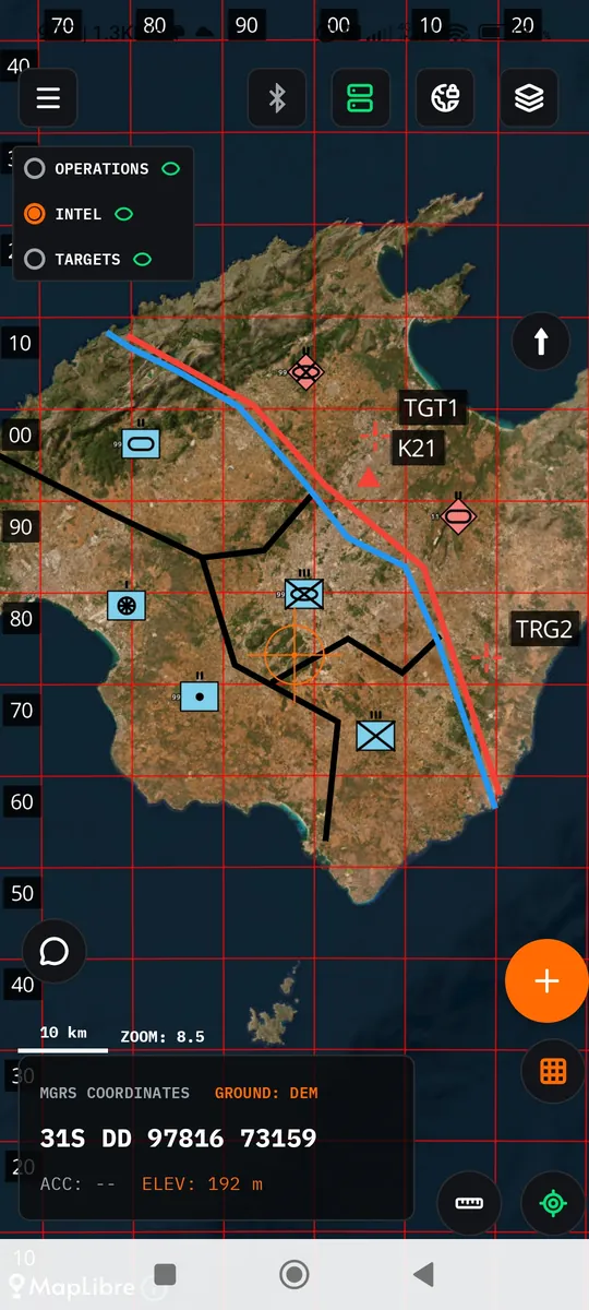
Shared Tactical Map
IRIS 3 is a field operations management app, designed to provide full autonomy and operational continuity in environments with no Wi-Fi or mobile network access (Off-Grid Operations). It can also work online, by connecting to a private server whenever internet access is available.
All core functions of the system, such as the tactical map display, the MGRS coordinate grid, report and target entries, and data exchange, run locally on the device. Online operation through a private server is optionally supported for data synchronisation whenever a connection is available.
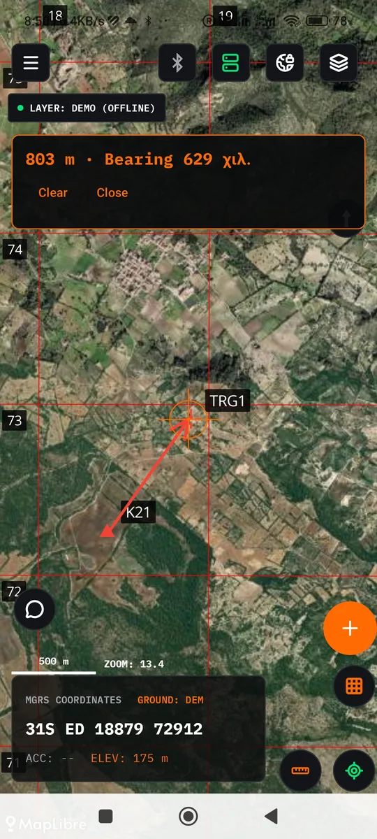
Move your pointer over the background: this is how the app's Distance and Bearing tool measures, in metres and mils.
Your data stays yours
IRIS 3 is built on one principle: field information belongs to the people who record it.
Stored only on your device
Targets, observers, layers, chats and positions are kept encrypted on the phone. There is no central IRIS 3 service that collects them.
Nothing leaves unless you decide
On every Send the app asks which channel to use, and there is always an explicit Cancel. Live position is off by default.
A private server, your own
If you want communication over the internet, you set up your own server (Oracle Cloud or a Raspberry Pi at home). It does not store message content: it forwards encrypted packets it cannot read and keeps only a small directory of devices.
A specific recipient, not the whole network
Devices pair with an expiring QR code, and every send through the server goes to one device or group, end-to-end encrypted.
The app also works fully without a server: the map, field entries and radio communication do not need one.
IRIS 3 is an independent project and no independent security audit has been published. Data you send physically reaches the recipients' devices, and Channel A hands it to another app that you choose. See the limits and basic security principles.
Communication between devices
IRIS 3 sends data over three channels. Every time you press Send, the app first asks where it should go out from, and there is always an explicit Cancel so nothing is sent by mistake.
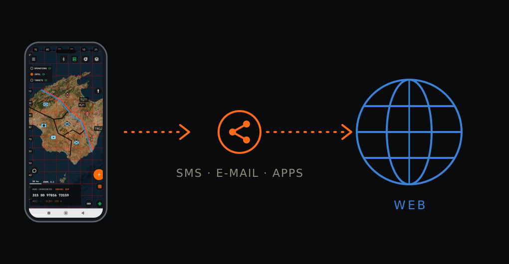
Share
Opens the Android share menu with ready-made text for the entry: SMS, email or any messaging app. It is always available and needs no Network Key.
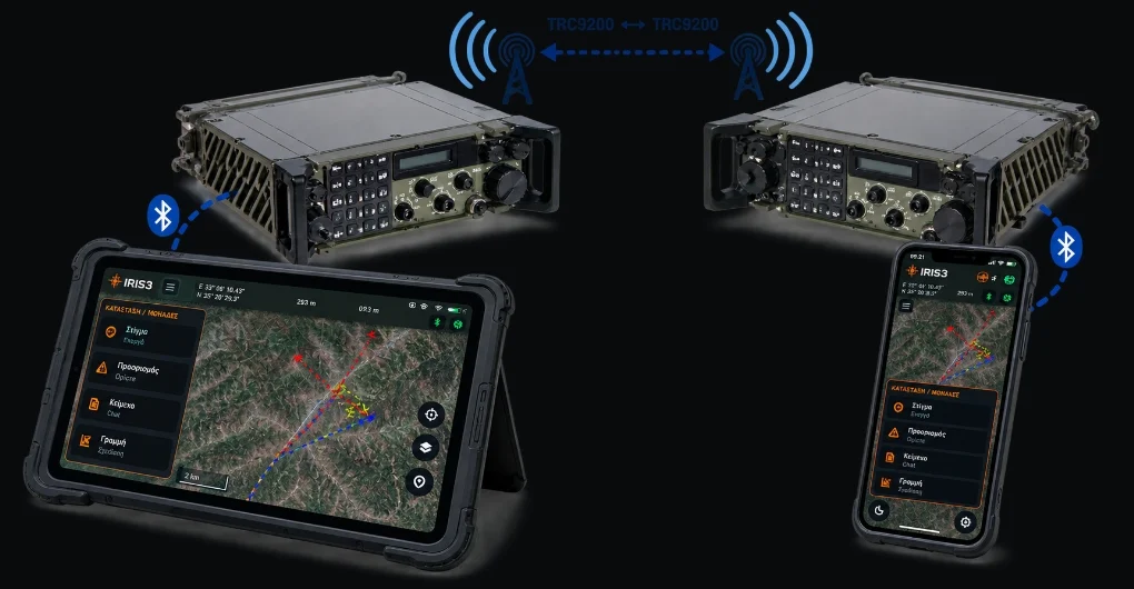
Over the radio
The channel for the field. The phone connects over Bluetooth to a bridge and from there to your radio. Traffic is encrypted with the Network Key and reaches every device on the network, with no Wi-Fi and no mobile data. Files up to 60 KB.
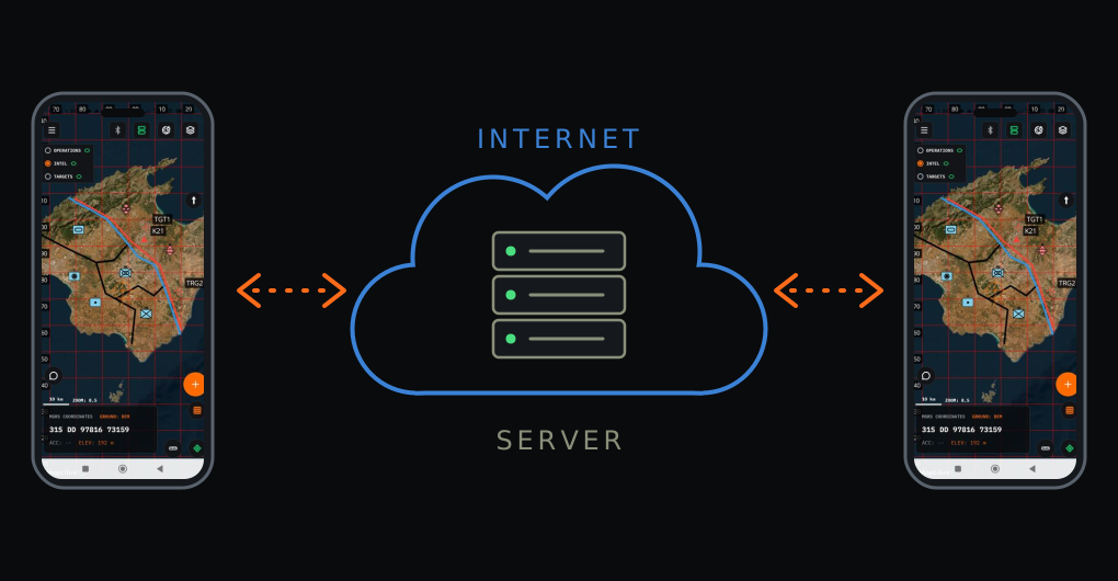
Via server
When there is internet, the message goes through your private server to one specific recipient or a group. Devices pair with each other using a QR code.
What you can send
- Text messages and files up to 60 KB, in Field Chat.
- Targets, observers and whole layers with one tap.
- Target assignment to a fire unit, with a message that opens the target on the recipient's map.
- Unit status: personnel, equipment, ammunition.
- Live position, shown as a marker on others' maps.
- Net check in one tap: see which devices answer and how well.
Sending over the radio is confirmed with an ACK and retried automatically if lost. Channels B and C can be active at the same time.
What the app does
The map is the core. Everything else starts from it.
A map that works offline
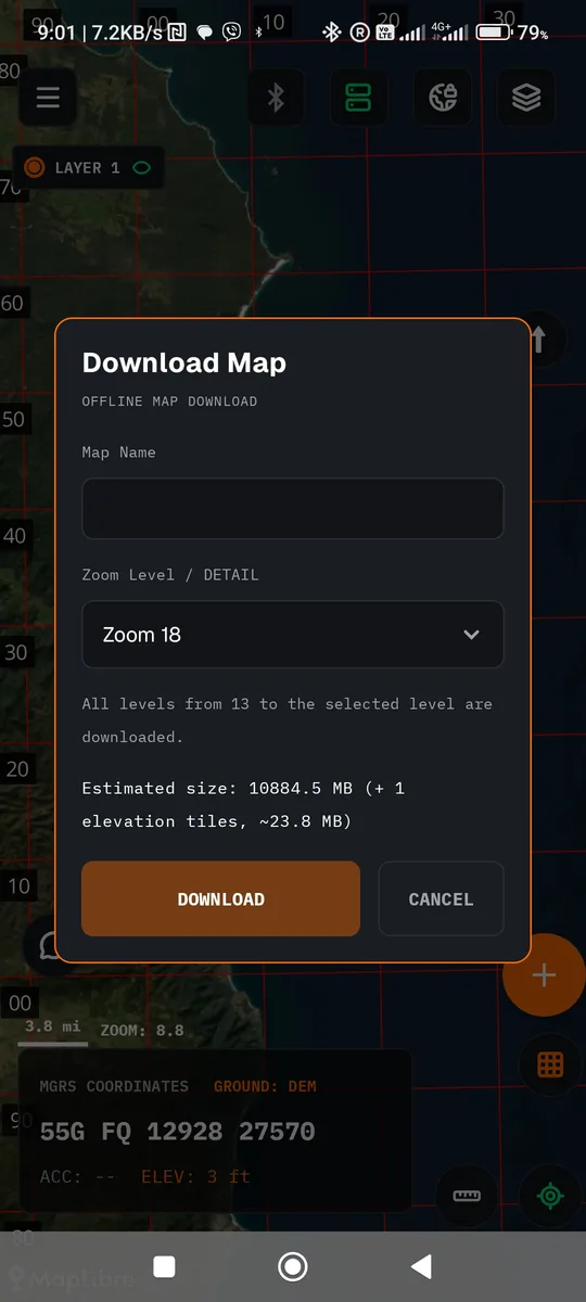
Download your operating area once. After that, the map needs nothing.
- Satellite background for the visible area, with a size estimate and progress bar.
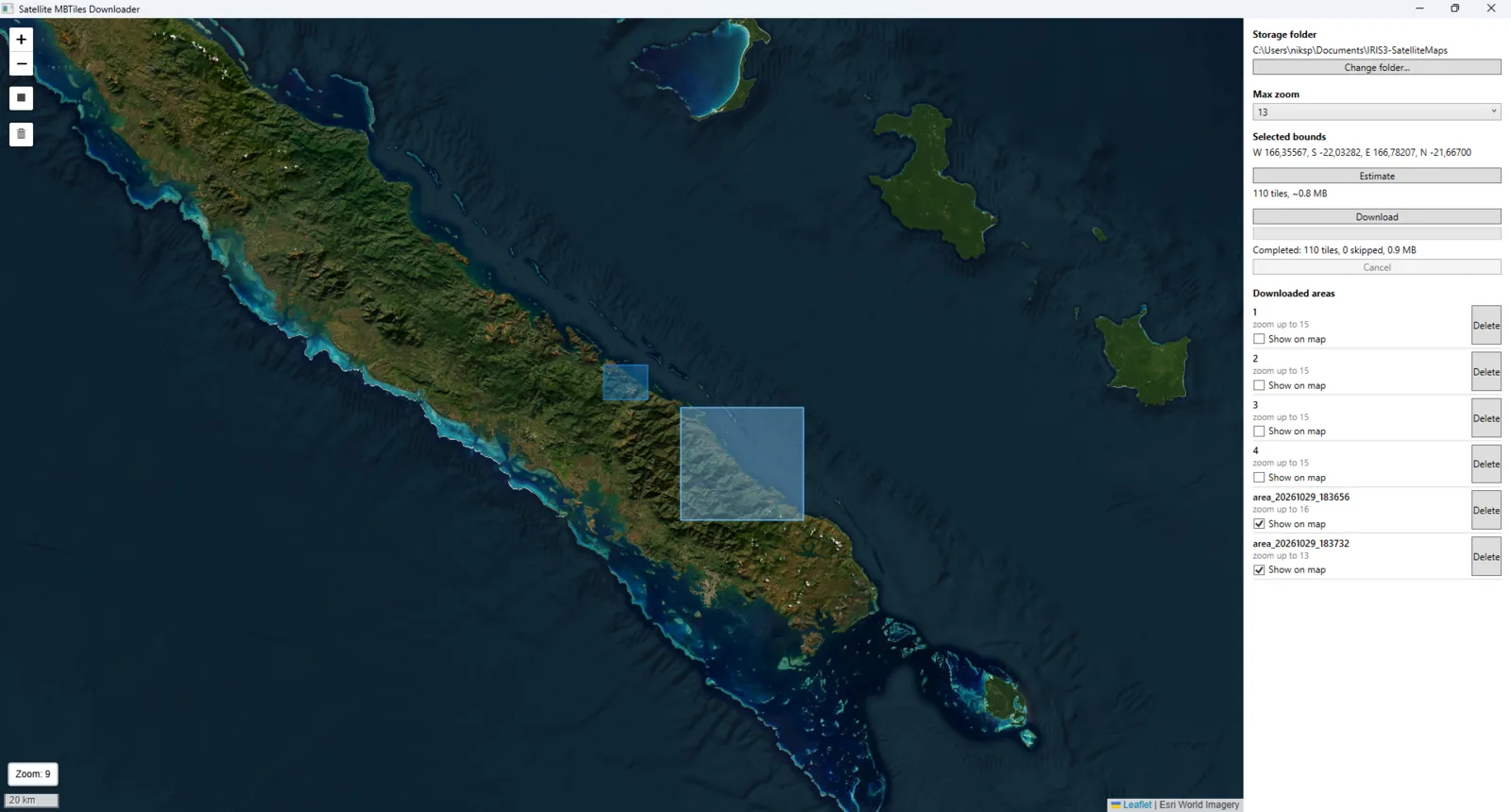
- Windows app (Satellite MBTiles Downloader) to download large satellite map areas from a computer, saved as .mbtiles files for IRIS 3.
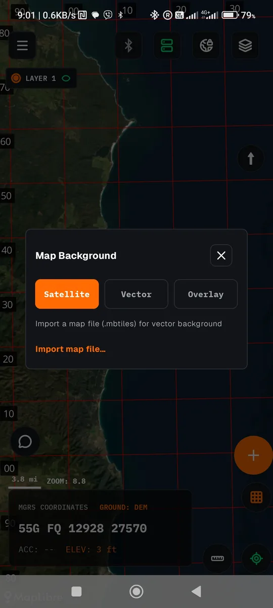
- Vector map and overlay from your own .mbtiles files.
- MGRS or UTM grid, with WGS84 or ED50 datum.
Measurements you need in the field
Every tool works from the map crosshair.
- Distance and bearing to the crosshair, live as you pan the map.
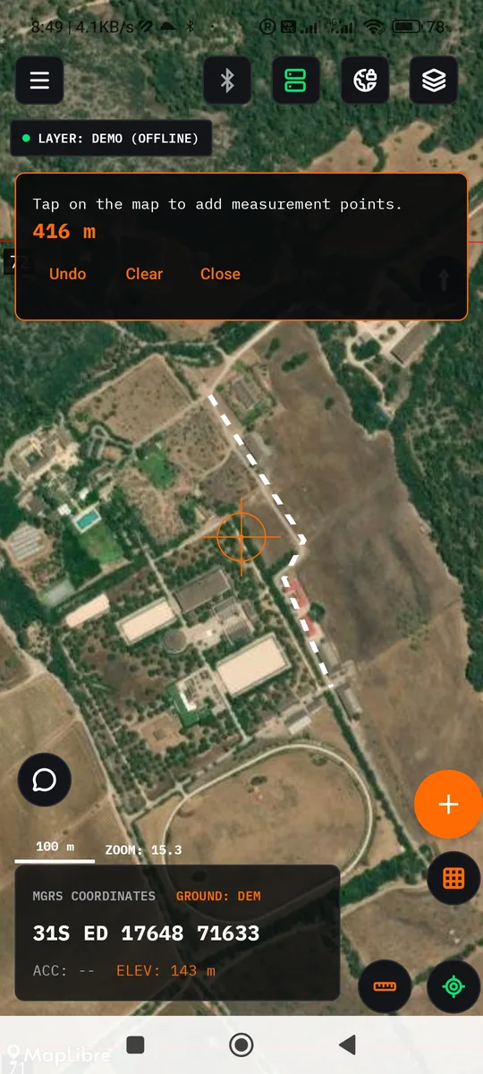
- Path measure with multiple segments and a running total.
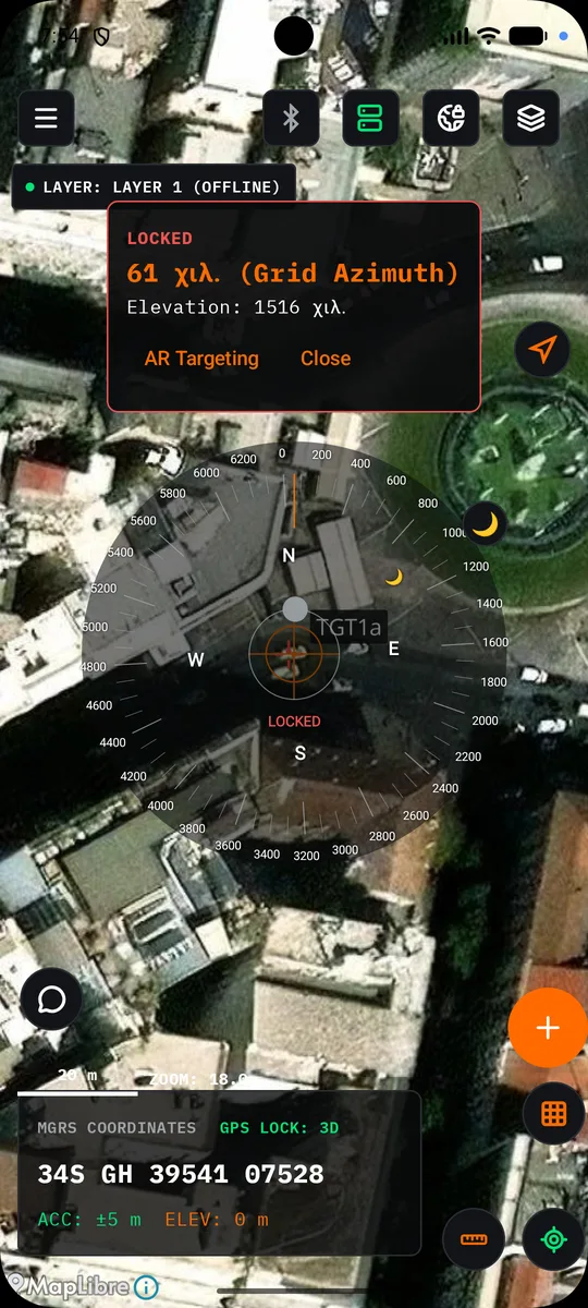
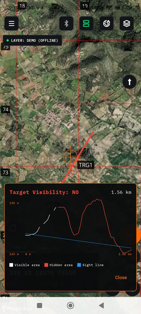
- Compass in mils and line of sight with a terrain profile.
Targets, observers and fire support
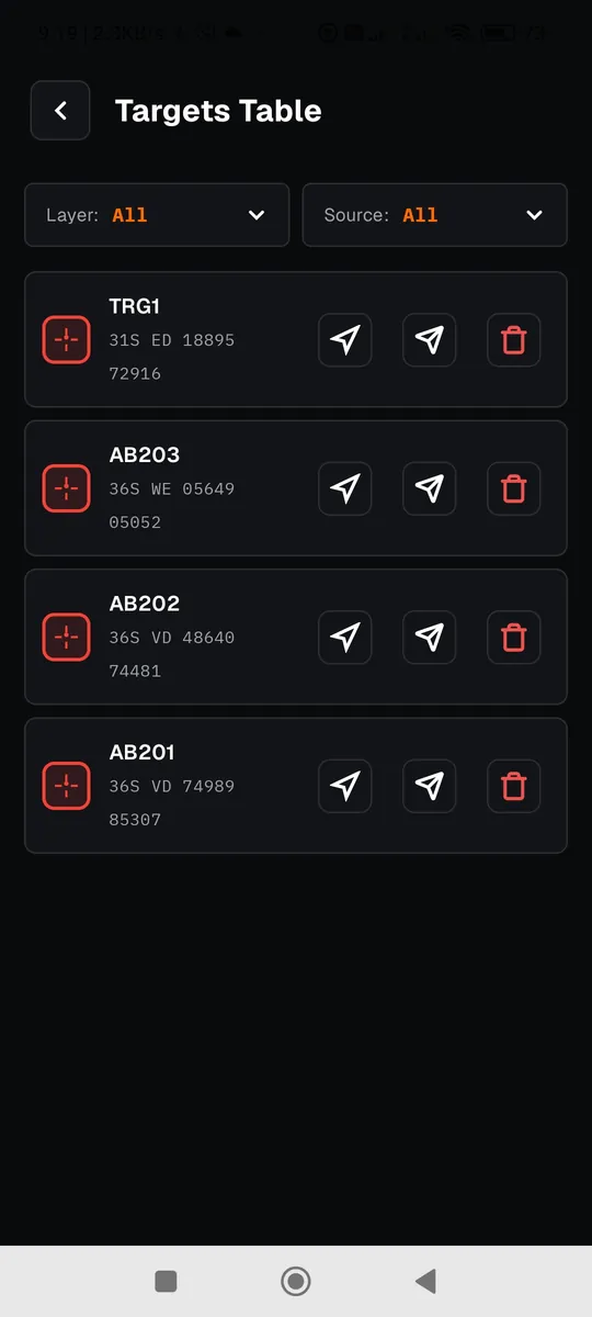
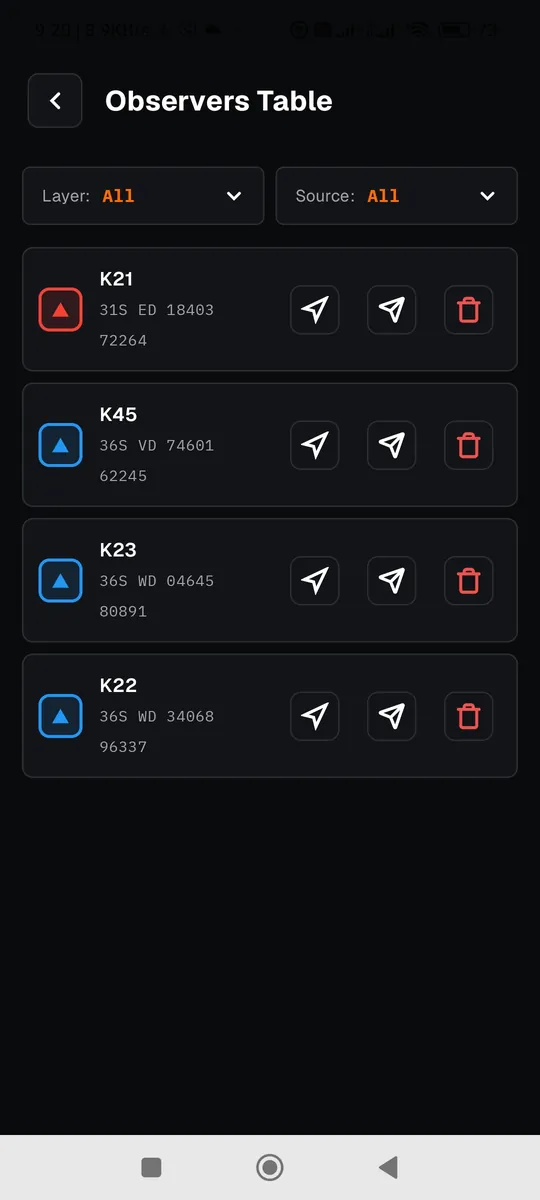
Whatever you record appears on the map and in a table, organised in layers.
- Targets, observers, text, lines, weapons, breaches and military symbols.
- Assign a target to a fire unit with a message that opens the target on the map.
- Fire distribution and an ROE table imported from CSV.
Field communication over your radio
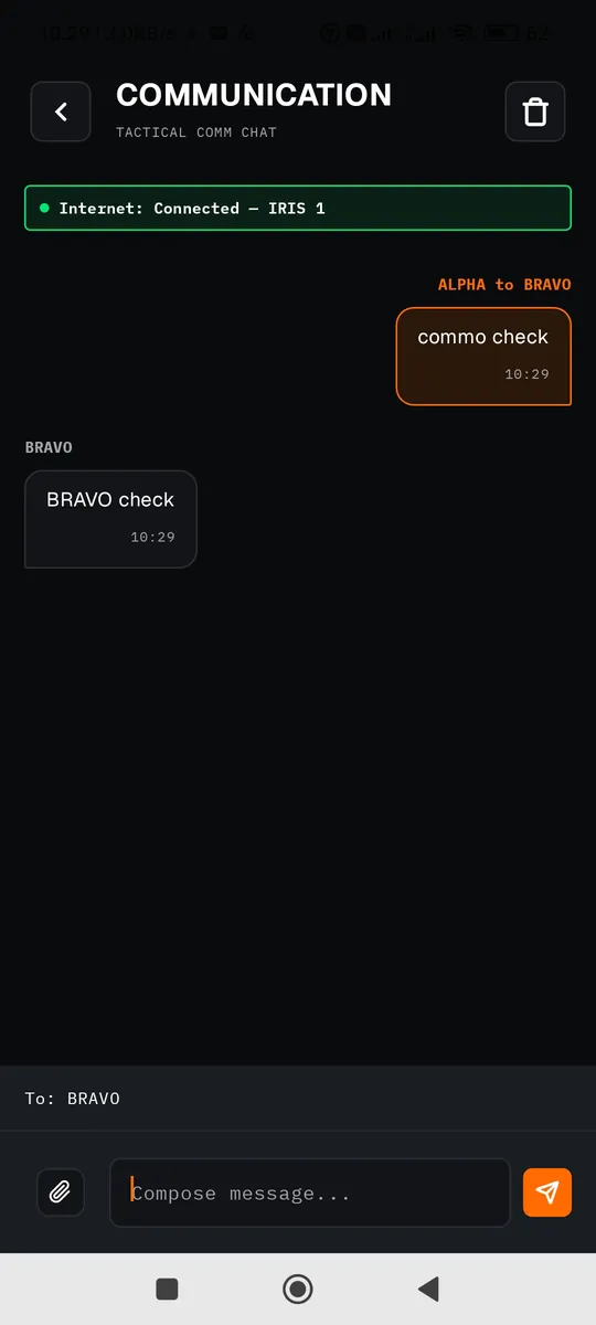
A Bluetooth bridge connects the phone to the radio you already have.
- Field chat and files up to 60 KB.
- Net check in one tap: see who answers.
- Unit status and live position on the map.
The other features
- Offline satellite map, with a size estimate and progress bar.
- Windows app (Satellite MBTiles Downloader) to download large areas from a computer.
- Vector map and overlay from your own .mbtiles files.
- MGRS or UTM grid, with WGS84 or ED50 datum.
- Distance and bearing to the crosshair, live.
- Path measure with multiple segments and a running total.
- Compass in mils and line of sight with a terrain profile (needs elevation data, which downloads when you are online).
- Targets, observers, text, lines, weapons, breaches and military symbols, in layers and a table.
- Fire distribution and an ROE table imported from CSV.
- Project saving and permanent data deletion with confirmation.
- Android platform, available through open testing on Google Play.
How it works
The phone does not talk to the radio directly. It talks over Bluetooth to a small bridge, and the bridge talks to the radio's serial port. The radio makes the network, not Bluetooth.
Before you leave for the field
Do these while you still have a connection and the whole team is together.
Download the maps
Zoom to your operating area and tap the download button.
Same datum and same Network Key everywhere
A different datum gives different coordinates for the same point. Without a shared key, the bridge neither sends nor receives anything.
Register fire units and weapon types
They are then ready for target assignment as soon as the mission starts.
Connect the bridge and run a Net Check
If every node shows up in the diagram, you are ready. Step-by-step connection.
From platoon to brigade
It starts at the smallest echelon that has a radio and reaches up to headquarters. The observer sends targets, position and reports up. Headquarters sends orders and overlays down.
For anyone working off the grid
Exercises, reservists, hunters, outdoor activities. Where there is no mobile coverage, your map and your team still work.
PC edition
IRIS 3 PC Edition for the operations centre is under development. It will let you manage and distribute the picture from a computer.
What to know before you start
| Platform | Android. |
|---|---|
| Radios | Tested: a suitable radio with a serial port. Any other radio with a data mode are expected to work but have not been verified. |
| Link to the bridge | Bluetooth Classic today. Wi-Fi Direct and BLE are under evaluation. |
| Files | Up to 60 KB per transfer. This is a limit of the bridge protocol. |
| Line of sight | Needs elevation data. It does not download with the map; it downloads when you request it while online. Run a calculation once over your area before you leave. |
| Distribution | Open testing on Google Play. |